 http://www.breathingearth.net/
RESURSE INTERACTIVE GRATUITE PENTRU UZ DIDACTIC
04.04.2009
Cei mici invata jucandu-se

http://www.fun4thebrain.com/index.html
Jocuri educative cu ursuleti , soricei si alte animalute dragalase pentru cei mici .
Etichete:
jocuri didactice
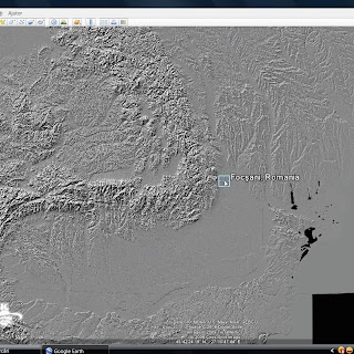
Shaded Relief Map for Google Earth

http://www.gearthblog.com/
GEB reader Jiro Shirota wrote to say he has completed a dynamic KML which shows Shuttle Radar Topography Mission (SRTM) digital elevation model in a shaded relief format for the Earth. He had previously released one for just North America back in 2007. The new global shaded relief map
Etichete:
google earth
03.04.2009
Abonați-vă la:
Comentarii (Atom)


